The Sverdlovsk Region lies on the slopes of the Middle, partly Northern Urals and in the vastness of the West Siberian Plain. All water bodies here belong to the basins of tributaries of large rivers - Kama and Irtysh. There are about 5.8 thousand natural and man-made water bodies in the region. 2 thousand of them have an area of more than 0.01 km2... The largest are Pelymsky fog and artificial reservoirs - Beloyarskoe and Volchikhinskoe.
Lakes and reservoirs of the region are a favorite vacation spot for local residents. On the banks of the reservoirs you can comfortably stay in tents. And for those who prefer a more comfortable stay, numerous recreation centers, sanatoriums, health camps offer their services. Most of the lakes are in demand among fishing enthusiasts. In some bodies of water, the water is so clean that crayfish live in them.
The most famous lakes of the Sverdlovsk region
List, photos with names and descriptions of the best lakes in the region!
Pelym fog
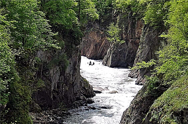
It is located in the Garinsky district, west of the village of Oshmarie, on the territory of a landscape reserve. The largest natural lake in the region. It lies in the valley of the Pelym River and was formed by its flood. Surrounded by forests where you can meet bears. Shallow, has a number of extended shoals. The bottom is muddy, with patches of sandy soil. Square - 65.7 km2... A nesting and resting place for many rare birds. Has a rich fish fauna. Located in a hard-to-reach place.

Read about the best places in the region: the main attractions of the Sverdlovsk region.
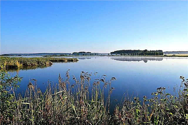
Tavatui
A beautiful lake in the Nevyansk region. Natural monument. Square - 21 km2... Lies in a basin of tectonic origin. Together with the neighboring Verkh-Neyvinsky pond, it forms a single water system. The bottom is pebbly and sandy, in places with rocky outcrops. The shores are dry, covered with forest vegetation. The water is clear and rather cold. There are many islands. Near the lake are the villages of Kalinovo, Priozerny, Tavatui, as well as camps and recreation centers.

Baltym
Located in the vicinity of Verkhnyaya Pyshma. Square - 7.5 km2... The source of the Baltym river. Most of the bottom is covered with sapropel, there are also sandy areas. A forest grows along the banks. The most "wild" is the north-western coast, where there is a swamp, Mount Zmeinka. On the rest of the coastline there are recreation centers, summer cottages, camps, country clubs, the Fisherman's House, as well as the villages of Sanatorny and Romashka. Fishing is popular.

Sandy
A picturesque reservoir in the Zheleznodorozhny district of Yekaterinburg, near the village of Severka. One of the most popular recreation areas among the townspeople. Occupies an area of 0.36 km2... The bottom is sandy, muddy in places. The eastern coast is built up with bases, sports camps; on the western side, the area is swampy. The shores are mostly made of sand, which explains the name of the lake. The Pshenichnaya and Ostraya mountains adjoin the reservoir, and the Chertovo Gorodishche rocks are 5 km away.

See: 15 best lakes in Yekaterinburg
Volchikhinskoe reservoir
Body of water with an area of 37 km2 in the vicinity of the town of Revda. It was created in 1944 on the Chusovaya River. Part of a landscape reserve. The bottom is silty, sometimes stony-pebble. The average depth is 3 meters. The southern coast is swampy, the northern coast is covered with forest. There are many islands. Volchikhinskoe is rich in fish resources. On the shores there are equipped beaches, fishing and hunting lodges and rest houses. Ski complexes have been built on the mountains adjacent to the reservoir.

Moltaevo
Lake 2.2 km2 on the territory of the Alapaevsky district. It is rich in bottom deposits of medicinal sapropel. In the middle of the last century, a mud bath was built here. Currently, its buildings are abandoned. The nearest sanatoriums are 15-20 km away, in the village of Samotsvet. The shores of the lake are gentle, in places overgrown with spruce forest. The average depth is 1.1 meters. Settlements on the coast - Moltaevo, Maevka, 4 km - Deevo.

Shchuchye
A small reservoir in the vicinity of the town of Tavda. Covers an area of 3.12 km2... The depth does not exceed 3 meters. The shores are partly swampy, the northern coast is sandy and covered with pine trees. The water is clean. The reservoir is attractive for anglers and fans of wild recreation. The village of Bolshaya Pustynya is located near the lake. From here, only an 8 km long hiking trail leads to Shchuchye. There are 2 more lakes nearby - Istochnoye and Sredny.

Talc stone
Natural and historical monument in the park "Bazhovskie mesto". Located 6 km from the city of Sysert, on the site of a flooded quarry, where talc was mined more than 100 years ago. Square - 0.01 km2... The maximum depth level is 32 meters. The reservoir lies surrounded by a coniferous forest, its shores are rocky cliffs 20-30 meters high, vertically sinking under the water. There are no fish, but frogs and newts are found. There is a trail for ATVs and snowmobiles along the lake.

It is interesting: 30 best natural monuments of the Sverdlovsk region.
Shartash
Located within the boundaries of Yekaterinburg, in a forested area. Popular with holidaymakers and fishermen. Square - 7.4 km2... The bottom is silty, partly stony. The most famous sights on the lake are Stone Tents, the remains of the Alexander Moat, Shartash megaliths. Recreation centers, camps, beach complexes, cafes, and a boat station are equipped on the shores of the reservoir. There are about 200 archaeological sites in the vicinity.

Beloyarsk reservoir
Located 45 km from Yekaterinburg. It was formed after the blocking of the Pyshma river by a dam in the interests of the Beloyarsk NPP. Square - 38 km2... The bottom is muddy, in places curled up, with rocky and sandy areas. The average depth is 9 meters. The shores are covered with forests, swampy in places. There is a lot of fish, especially in the upper reaches of the reservoir and in several bays. On the coast is the village of Zarechny, as well as a number of recreation centers, camps, equipped beaches, boat stations.

Bottomless
Natural monument. It is located in the taiga wilderness, in the Gornouralsky urban district. Has a compact size - an area of 0.05 km2, but at the same time the depth of the reservoir is measured by 5 tens of meters. Another name - Karst - explains the origin of the lake basin. On all sides the reservoir is surrounded by a forest, in some places there are rocky outcrops. The bottom is rocky, partly silty, filled with fallen trees. Nearby is the Smorodinskoe reservoir.

Chusovoe
A small reservoir 20 km from Yekaterinburg, near the village of Chusovskoye Lake. Popular with fans of wild recreation. Occupies an area of 2 km2... Lies in a wooded swampy area. The bottom is mostly muddy, occasionally pebble and sandy. The lake is connected to the Chusovaya River through a flowing stream. There are sandy beaches, a summer cafe, a boat station. The sanatorium of the same name is located on the northern bank of the Chusovoy. Several primitive sites have been discovered.

Reftinskoe reservoir
It is located in the Asbestovsky district, 70 km from Yekaterinburg. It was created in the 60s by damming the Reft River for the needs of a coal-fired power plant. Occupies an area of 25.3 km2... The banks are dry, mostly overgrown with forest. The greatest depth is 22 meters. The reservoir is known for its rich ichthyofauna. Repeatedly stocked with different breeds, sturgeon and trout are raised in cages. The village of Raftinsky is located on the coast, tourist centers and camps have been built. Rest in tents is possible.

Isetskoe
Located near Severouralsk. It was formed in the 19th century after the construction of a dam on the Iset River. The water is used by the Sredneuralskaya GRES. Lake area - 24 km2... Shallow, average depth - 2.5 meters. Lies surrounded by picturesque forests and mountains. This entire area has been transformed into a landscape reserve. The bottom is muddy, with sandy areas. Plenty of fish. There are several recreation centers on the banks. Fragments of ancient settlements were discovered.

Gurino
Sight of the famous Pripyshminskie Bory park. Square - 2.12 km2... Has a triangular shape. The banks are high, sandy, and tall pine trees approach the very edge of the water. The Lipka River starts in Gurino. The reservoir is attractive for anglers. Settlements on the shore - Ivanovka, Gurina, Fominskoye. There are also 2 camps and a hunting farm. The lake is part of the tourist routes in the park.

Tygish
Located 15 km from the city of Kamensk-Uralsky, 1.5 km from the village of Rybnikovskoe. It communicates with Lake Malye through a channel, and the salt lake Bolshoy Sungul is 2 km away. Reservoir area - 6.7 km2... The average depth is 1.5 meters. The bottom is muddy, with algae. The lake was stocked with carp, pike, silver carp, carp, etc. There are many waterfowl. On the shore there is a recreation center with houses, gazebos, a large beach area, boat rental.

Schelkunskoe
A small closed body of water in the Sysert region. A popular country holiday destination. Covers an area of 5.5 km2... The shores are sandy, open, with bushes and small groves. In the northern part there is the village of Shchelkun, on the west coast - the cottage village of Lukomorye. It is considered to be a purely crucian water body; even people from the neighboring region come here for this fish. Almost any place on the lake can be reached by a convenient road.

Bagaryak
A small reservoir 50 km from Yekaterinburg, near the village of Kosmakovo. The source of the Bagaryak river. It is located on the outskirts of the Bazhovskie Mesto nature protection zone. Area - about 3 km2... Average depth indicators are 2-3 meters. The water is very clean thanks to the keys at the bottom of the reservoir. Part of the coast is swampy, some areas are built up with cottages. The bottom is muddy. From time to time the lake is stocked with carp, crucian carp, silver carp. You can rent a boat.

Verkhnemakarovskoe reservoir
An artificial reservoir 30 km from the center of Yekaterinburg, on the Chusovaya river. It was created as a result of the construction of a dam in the 70s of the last century. Lies on the territory of a landscape reserve. Has an area of 17.6 km2 and an average depth of 4-5 meters. One of the favorite places for fishing and recreation among the townspeople. It is famous for its great fish variety. Most of the coast is hilly and covered with forest. On the lake are the villages of Verkhnemakarovo, Kurganovo, there are several recreation centers.

Deaf
Natural monument. It is located within the urban district of Pervouralsk, in a remote place, in the middle of swamps and mixed forests. Area - 0.64 km2... Shallow, average depth does not exceed 1 meter. There is a large Glukhoe bog nearby. Waterfowl nest on the lake. The banks are covered with sphagnum. The coastal forests are teeming with mushrooms and berries. Fishing on the lake is preferable from a boat. The health complex of the same name is located on the shore.

Light
Natural monument. It is located in the territory of the Severouralsk urban district, among low mountains, overgrown with mixed forest and dark coniferous taiga. Square - 3 km2... It features clear cold water and excellent fishing. The bottom is pebble-stony, silted in some areas. The greatest depth is 38 meters. There are many underwater springs. Part of the coast is swampy. The village of Vsevolodo-Blagodatskoye is located on the shore, and there is also a recreation center.

Shitovskoe
Located in a forest swampy area, 15 km from the town of Verkhnyaya Pyshma. On the one hand, a large swamp of the same name adjoins the lake, the other side is relatively dry. Square - 6.2 km2... The bottom is predominantly muddy. The maximum depth does not exceed 2 meters. Of the several islands on the lake, the largest is Travyanoy. Fishing is popular, in 2006 Shitovskoye was stocked with carp. On the shore there is a base for hunters and fishermen, there is a boat rental.

Ayat reservoir
Body of water with an area of 28.3 km2 on the territory of the Nevyansk region. Until the beginning of the 19th century, there were 3 lakes in its place. The Ayat River flowed out of one. But after it was dammed up, the water level in the source lake rose, and it merged with the two remaining ones. The average depth of the reservoir is 2 meters. The banks are mostly swampy. There are several islands, on one of them - Saint - a miracle-working hermit lived in the 18th century. The lake and the surrounding forests form a landscape reserve.

Kurtuguz
The natural monument, together with the adjacent territories, is part of the landscape reserve. Located in the urban district of Bogdanovich. Surrounded by mixed forest. Square - 10.6 km2... There are sapropel deposits at the bottom. The lake is rich in fish. The surrounding swamps are a nesting place for numerous ducks. You can meet the muskrat. In summer, there are a lot of midges on the banks, you need to stock up on repellents. In the vicinity are the villages of Melekhina, Kunarskoye.

Izbulat
Lake on the outskirts of Degtyarsk with an area of 0.78 km2... It is surrounded by forest on the north and east sides, the south coast is partially built up. The bottom of the lake is sandy, sometimes covered with sapropel. The banks are gentle, the water is clear, it warms up well. In summer there are many tourists. Fishing bridges are installed along the coast, there are gazebos, boat rental. Among the locals, there are legends about the innumerable treasures of Pugachev, hidden at the bottom of the lake.

Nekrasovskie lakes
Two stocked reservoirs on the Kamenka River, in the vicinity of the village of Nekrasovskoye. They have an elongated shape, one lake is slightly larger than the other. The shores are gentle, sandy, on one side surrounded by a patch of mixed forest. On the other side there is a base offering heated holiday houses, a Russian bathhouse, a beach area, boat and catamarans rental, fishing trips. Along the lakes there are places for wild camping in tents.

Big Sungul
Salty reservoir 8 km from the city of Kamensk-Uralsky. Has an area of 10.2 km2... The average depth is 4 meters. The water is clear, a lot of fish. Fishing competitions are sometimes held. There are swimming beaches. The lake is popular with kite fans. Vacationers come with tents. There is no infrastructure ashore. The nearest sanatoriums, recreation centers and camps are located in Kamensk-Uralsky. Lakes Tygish and Chervyanoe are located nearby.

Irbitskoe
Natural monument. It is located 35 km from the town of Sukhoi Log, in a wooded swampy area. One of the cleanest lakes in the area. Square - 19 km2... The bottom is sandy. On the east side there is a large Lyagushachye swamp, on the west coast there is the village of Maly Taushkan. In 2006-07, it was stocked with crucian carp, peled, and ripus. Two recreation centers with houses, gazebos, and a bathhouse were built on the shore. There is an opportunity for wild camping in tents.

White
A shallow flowing lake in the Artyomovsky district, near the village of Pokrovskoye. Landscape nature monument. The banks are swampy, surrounded by forest, and in some places there are rare species of orchid plants. The water is clean, healing sapropel lies at the bottom. The river Istochnaya starts in Beloye Reservoir area - 5.28 km2... Fishing is popular. There are places for tents on the shore. Those who wish can rent a boat.

Great Vagil Mist
A large lake near the village of Novy Vagil, within the Garinsky urban district. Located in a hard-to-reach area. Square - 31.2 km2... The channel connects with the neighboring Small Vagil fog. The banks are covered with forest, partly swampy. The water is clear, brownish in color. There are several islands in the northern part. The river Vagil flows out. Archaeological research is underway along the shores.